UN
26a Beach Walk
£ 899,950
Description
We don't have a Description for this property.
- Bedrooms
- 4
- Bathrooms
- 0
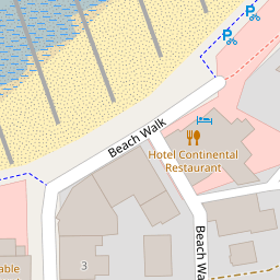
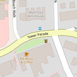


Leaflet © OpenStreetMap contributors
The heatmap indicates the level of crime in the area. The color of the heatmap indicates the crime severity and recency.
Metrics Year-on-Year
- Average area value
- 597,609.00 £Decreased by 21.29 %
- Average area rental value
- 1,299.00 £/moDecreased by 27.63 %
- Est rental Yield
- 2.61 %Decreased by 8.10 %
- Crime Rate
- 13.00 %Unchanged by 0.00 %
from 759,262.00 £
from 1,795.00 £/mo
from 2.84 %
from 13.00 %
Nearby Schools
| Name | Type | Ofsted | Distance |
|---|---|---|---|
| Westmeads Community Infant School | Community School | Outstanding | 0.52 KM |
| St Mary'S Catholic Primary School, Whitstable | Academy Converter | Good | 0.77 KM |
| Isp Polar Re Start Centre | Other Independent Special School | 0.86 KM | |
| Whitstable And Seasalter Endowed Church Of England Junior School | Voluntary Aided School | Outstanding | 0.96 KM |
| Whitstable Junior School | Foundation School | Good | 1.22 KM |
Images
Nearby Streets
| Name | Average Price | Average Sqft | Distance |
|---|---|---|---|
| Northwood Road | £ 449,995 | 0 | 0.00 KM |
| Brices Alley | £ 0 | 0 | 0.00 KM |
| Wheelers Alley (CWX32) | £ 0 | 0 | 0.00 KM |
| Freeman's Yard | £ 0 | 0 | 0.00 KM |
| Salt Pans Lane | £ 360,000 | 0 | 0.00 KM |
Nearby Transport
| Name | NLC | TLC | Distance |
|---|---|---|---|
| Whitstable | 5196 | WHI | 0.75 KM |
| Chestfield And Swalecliffe | 5200 | CSW | 3.88 KM |
| Herne Bay | 5174 | HNB | 9.47 KM |
Nearby Listings
| Address | Price | Type | Score | Distance |
|---|---|---|---|---|
| Beach Walk, Whitstable | £ 750,000 | BUY | Unknown | 0.03 KM |
| Tower Hill, Whitstable | £ 485,000 | BUY | 6 / 10 | 0.07 KM |
| Tower Parade, Whitstable | £ 1,050,000 | BUY | Unknown | 0.10 KM |
| Tower Parade, Whitstable, Kent, CT5 | £ 230,000 | BUY | 4 / 10 | 0.14 KM |
| Northwood Road, Tankerton, Whitstable | £ 650,000 | BUY | Unknown | 0.14 KM |
Nearby Properties
| Address | Price | Distance |
|---|---|---|
| 26 Beach Walk | £ 688,500 | 0.00 KM |
| 26a Beach Walk | £ 899,950 | 0.00 KM |
| 10 Tower Parade | £ 55,000 | 0.13 KM |
| 8 Tower Parade | £ 875,000 | 0.13 KM |
| 1b Tower Parade | £ 152,500 | 0.13 KM |